Unfolded· 8 min read·5 September 2026
The Desert That Faces the Sea
The Reserva Nacional de Paracas, 335,000 hectares of protected coastal desert and Pacific Ocean — a private 4x4 programme with a marine biologist through the Peninsula de Paracas, the seasonal Andean flamingo colonies, the red-rock coastline, and the Candelabro read from land as the day's orienting landmark.
By Kada Travel Editorial
The geography of the Reserva Nacional de Paracas operates on a principle that most landscapes do not: the desert and the sea are not opposites here. They are the same system, expressing different states of the same aridity. The cold Humboldt Current running against the coast produces fog and fish abundance; the fog feeds the coastal ecosystem; the cold water and the prevailing offshore winds prevent rain from forming over the desert; the desert, having no rain, becomes the most legible natural archive in Peru. Everything that was placed in the ground here — the Paracas culture's burials in the cliffs of the Cerro Colorado, the mummies at Chauchilla inland — is preserved by the same atmospheric condition that makes the Pacific visible from the desert's edge as a flat grey surface between the ochre cliffs.
The reserve encompasses 335,000 hectares of this combined system: the Peninsula de Paracas with its red-rock coastline, the protected bays where flamingos winter, the sea from the peninsula edge to the territorial limit offshore, the hillside where the Candelabro geoglyph is carved, the unpaved roads through the desert interior. It is Peru's only protected marine area, and its management of the marine ecosystem and the coastal desert as a single unit is the logic that makes the reserve's ecology legible rather than fragmentary.
The standard visit to the Paracas Reserve is a half-day in a shared minibus making scheduled stops at designated viewpoints. The Kada programme is a full day in a private 4x4 with a marine biologist — not a nature guide, but a researcher whose professional understanding of the reserve's ecology extends from the offshore zone where the Ballestas colony feeds to the inland bird colonies of the protected bays. The stops are the same landmarks. What is said at each one is not.
The Reserve in Two Registers
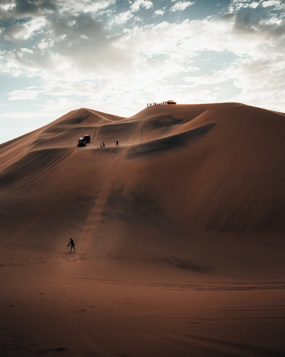
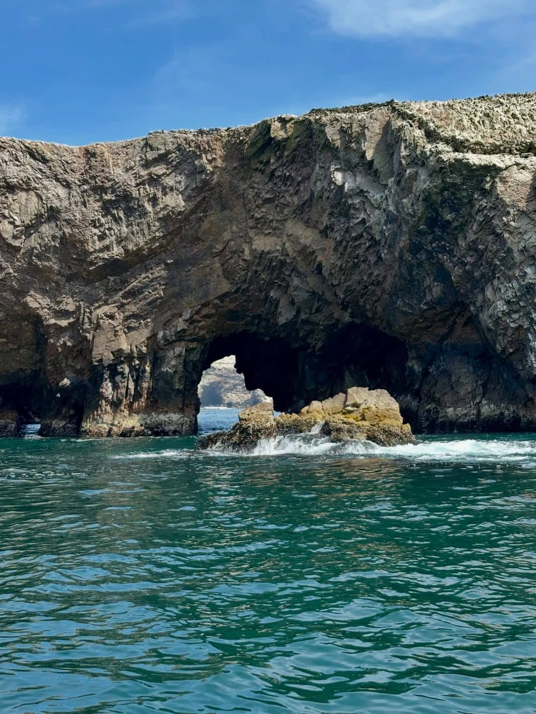
The inland portion of the reserve — the desert peninsula — reads as geology at its most extreme. The Paracas peninsula is composed of red and ochre volcanic rock, shaped by wind erosion into cliffs, arches, and rock stacks above the Pacific. The beaches between the formations range from the white sand of La Mina and Yumaque to the red granitic gravel of Playa Roja — the beach whose characteristic colour comes from the breakdown of the volcanic rock above it. There is no developed beach infrastructure in the reserve; the beaches are empty of permanent human presence.
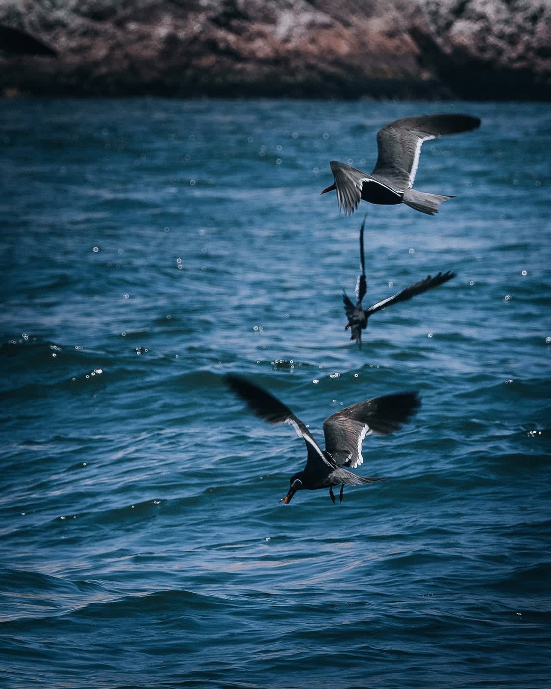
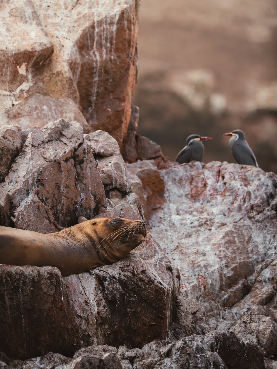
The offshore portion — the marine protected area — is where the Humboldt Current ecosystem is most productive. The reserve was established in 1975 specifically to protect the guano-producing bird colonies and the anchovy stock that feeds them. The guano colonies on the Paracas coast and the Ballestas Islands were harvested for agricultural export throughout the nineteenth and early twentieth centuries, causing ecosystem damage that the reserve designation began to reverse. The connection between the inland and offshore portions is direct: the flamingo colonies that winter in the protected bays are feeding on the same brine shrimp and algae that the cold current brings to the shallow coastal waters.
The Andean Flamingos
Three flamingo species occur in Peru — the Chilean flamingo, the Andean flamingo, and the James's flamingo. Their presence on the Pacific coast at Paracas is seasonal: the colonies that use the reserve's protected bays in the austral winter are birds moving between their high-altitude salt lake breeding grounds (Lago Colorada in Bolivia, the Atacama salt lakes in Chile) and their coastal feeding grounds. The Paracas bays, with their shallow water and high brine shrimp density, are among the principal coastal staging areas for the Andean flamingo on the Pacific coast of South America.
The fact that flamingos appear here — that the same desert coast that preserves Nasca mummies and Lines holds a significant colony of one of the most visually improbable birds on earth — surprises most guests. The marine biologist's explanation of the flamingo's presence in terms of the Humboldt Current ecosystem converts the visual surprise into ecological logic: the flamingo at Paracas is not anomalous but entirely consistent with the coastal food web that the current drives. It is the same cold water, ultimately, that explains the mummies, the flamingos, the penguins, and the fishing culture that eventually produced ceviche.
The Candelabro from Land
The geoglyph visible from the sea during the Ballestas crossing — the trident-form figure incised into the northern headland of the peninsula — is reachable by road within the reserve to a viewpoint above the bay. The land view differs from the maritime view: from the boat, the figure is seen nearly straight-on; from the land viewpoint, at an elevation closer to the geoglyph's own level, the depth and precision of the incision into the sandy hillside is more legible. The figure is large — approximately 180 metres from the lowest branch tip to the top of the central element — and its orientation toward the Pacific, specifically toward the offshore direction of the Ballestas Islands, has suggested to some researchers a function as a maritime navigation marker. This is unverified.
The biologist who accompanies the reserve programme is not an archaeologist; the Candelabro is addressed as a landscape feature rather than as an object of primary expertise. The combined effect of seeing it from the boat on the Ballestas dawn visit and then from the land during the reserve programme gives the geoglyph its fullest context: the maritime and terrestrial landscapes it stands between, and the visual relationship between the inscription and the sea it faces.
Lagunillas and the Table on the Cove
Lagunillas is a small fishing cove within the reserve — a protected bay where a handful of fishing families maintain vessels and where the morning catch arrives by mid-morning. The cove is within the reserve boundary; the fishermen operate under Sernanp coordination, which limits the number of boats and maintains the bay's ecological condition.
Kada includes lunch at Lagunillas as a standard element of the reserve programme: a simple ceviche prepared using the morning's catch, served at the water's edge, with the Humboldt Current's grey Pacific visible from the table. The specificity of this lunch — the corvina or the flounder or the shellfish from the same cold water visible fifty metres away — is not incidental to the programme. It is the point at which the day's ecological argument arrives at the table: the reserve, the current, the fish, the preparation. The ceviche at Lagunillas is the same cold-water food chain that the biologist has been describing since before sunrise, served simply in the cove where the boats come in.
What Kada Arranges
Private 4x4 from the hotel at Paracas: full-day programme including the reserve entrance, the coastal route through the principal formations (La Mina, Playa Roja, the Yumaque zone, the northern headland viewpoint above the Candelabro), and the southern route through the flamingo bays if the colony is in seasonal residence.
The marine biologist on the programme is the same individual, or a research colleague from the same station, as the biologist for the Ballestas dawn visit. Kada designs these as a two-programme Paracas sequence — Ballestas at pre-dawn on day one, reserve on day two — so that the species and ecology encountered on the water are given terrestrial context and continuation. The reserve programme is the land equivalent of the Ballestas circuit: the same ecosystem, the same expert, the different vantage point.
The programme ends in the late afternoon back at Paracas, with the afternoon's marine light on the reserve's red-rock coastline providing the visual close to a day that started before sunrise on the water.
Expert Perspective
"The question I get most often at Paracas is: why does a desert have flamingos? And it is the right question. When you understand the answer — the Humboldt Current, the cold upwelling, the brine shrimp, the migration route from the Bolivian salt lakes — you understand the reserve. Not just as a bird count but as a system. The flamingo at Paracas is the same ecology as the sea lion at the Ballestas, the same ecology as the anchovy in the ceviche, the same ecology as the fog that kept the Nasca mummies intact for fifteen hundred years. Once guests get that connection, the rest of the day is a different kind of seeing. They are not ticking off species. They are reading the system."
— Daniel Ramos, Co-Founder & CEO, KADA Travel
A Practical Note
Roads: the reserve roads are unpaved and require a high-clearance vehicle; the 4x4 arranged by Kada is appropriate for all standard conditions. The circuit is a full-day programme of approximately seven to eight hours including travel from the Paracas hotel.
Weather and wind: the paracas wind — a strong sand-laden westerly for which the region is named — develops in the late morning and can make the afternoon sections significantly windier than the morning. Sun and wind protection are both relevant; the desert is exposed with no tree cover. Mornings are calmer; the programme schedule is built around this.
Flamingo seasonality: the flamingo colony is present in the reserve from approximately April through November, with peak numbers in the austral winter (June-August). Outside this window, the flamingo component is absent; the reserve visit proceeds with coastal geology and the resident bird species. Kada communicates seasonal availability at booking.
Physical demand: minimal. The programme is vehicle-based with walking at viewpoint stops; most stops involve ten to twenty minutes on foot over level or gently uneven terrain. No strenuous climbing is required.
Written by Kada Travel Editorial
Frequently Asked
The colony is present seasonally (approximately April through November). Kada communicates expected presence based on the visit date at booking. The biologist can provide current colony status before departure. The flamingo component is a significant element of the programme in season; the reserve visit is substantive without it when they are not present.
Yes. The two programmes run at different times — Ballestas at pre-dawn, reserve from mid-morning — and are combinable in a single day for guests with the energy for a full Paracas programme. The Ballestas circuit returns before eight, the reserve programme begins after nine, and the day ends in the late afternoon. Kada designs this as a standard two-programme Paracas day for guests with adequate time.
The Paracas culture (approximately 800 BCE – 200 CE) predates the Nasca and is known primarily for its extraordinary textile tradition — the woven and embroidered garments found in the burial bundles of the Paracas necropolis are considered among the finest textiles in the pre-Columbian Americas. The Paracas culture overlaps geographically with the Nasca, and the transition between the two cultures is gradual rather than sharp. The biologist addresses the reserve's cultural geography in the context of the site's history, not as the programme's primary expertise.
The reserve holds year-round resident species including South American sea lions on the coast, Humboldt penguins in cliff formations, Peruvian pelicans, Guanay and Neotropical cormorants, Peruvian boobies, Inca terns, and resident shorebirds. The reserve is biodiverse year-round; the flamingo colony represents the most visually dramatic seasonal variation rather than the difference between a wildlife programme and an empty desert.
Design Your Journey
Design your bespoke Peru journey
We talk. We listen. Then we design an itinerary that belongs only to you.
Start Planning